Calculate Your Local Daily Peak Sun Hours by US State and City
Locate your specific municipal geographic tracking zone to reveal exact localized daily solar insolation metrics.

What Is the Difference Between Total Daylight Hours and Peak Sun Hours?
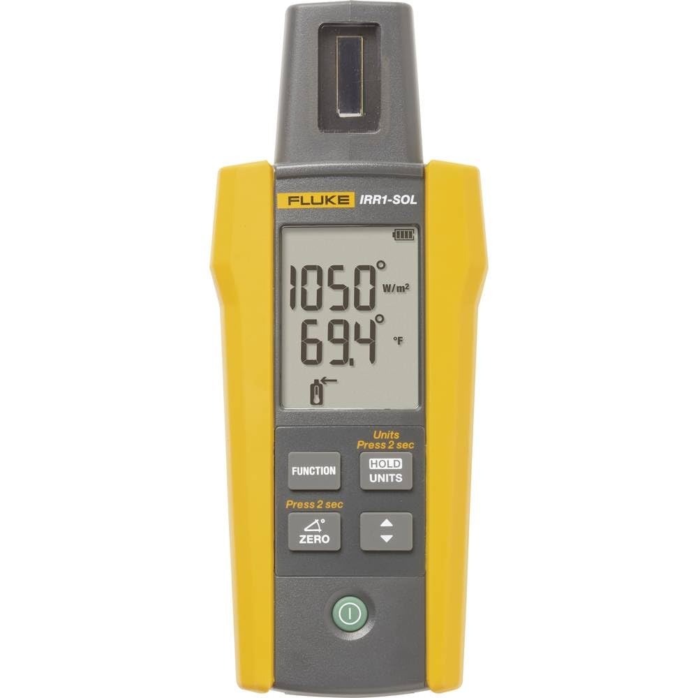
Total daylight hours track the entire duration between sunrise and sunset, regardless of light quality. In contrast, a peak sun hour represents a standardized unit of time where local solar radiation intensity reaches a full baseline density of one thousand watts of light energy per square meter (1 kW/m²).
For instance, while a northern city might experience 14 hours of total daylight during a summer cycle, its geographical light composition may only register 4.2 peak sun hours of real, high-intensity generation potential.
How to Map Solar Asset Densities Using the Peak Sun Hours Calculator
This geographic mapping matrix matches localized weather records directly to hardware design models. Configure your options as follows:
- US State Menu: Select your primary state territory boundary layer. This filters our comprehensive national climate matrix to isolate regional infrastructure pools.
- Nearest City / Region Menu: Select the municipal weather tracking center nearest to your home. This activates local historical irradiance variables.
- Target System Size (Optional): Input your planned nameplate array capacity in kilowatts (kW) to unlock live daily energy yield estimates.
Why Latitudes and Microclimates Dictate Solar Asset Returns
A common mistake when designing a residential renewable energy system is assuming that total clear sky visibility translates directly into heavy power generation. Homeowners in northern states often look at long summer days with deep daylight windows and assume their production potential will match or beat southern states. In reality, a solar panel requires a specific density of solar radiation to hit its full power output.
Early morning sunrise and late afternoon sunset light hits your roof at a shallow angle, passing through a thicker layer of the Earth’s atmosphere. While this light creates visible daylight, its solar radiation intensity drops well below the required threshold. Peak sun hours measure only the specific times of day—usually between 10:00 AM and 2:00 PM—when sunlight strikes your modules with full intensity.
US Regional Peak Sun Hour Reference Matrix
The table below presents standardized year-round daily averages for primary high-intent US metropolitan hubs along with corresponding generation yields:
| US Region Node | Major City Tracker | Daily Peak Sun Hours | Annual Insolation Pool | Daily Yield (8 kW System) |
|---|---|---|---|---|
| Northeast Tier | New York City, NY | 4.2 Peak Hours | 1,533 hrs / yr | 27.6 kWh / day |
| Midwest Baseline | Chicago, IL | 4.1 Peak Hours | 1,497 hrs / yr | 26.9 kWh / day |
| Southeast Coast | Miami, FL | 5.2 Peak Hours | 1,898 hrs / yr | 34.1 kWh / day |
| Southwest Desert | Phoenix, AZ | 6.2 Peak Hours | 2,263 hrs / yr | 40.7 kWh / day |
What Do My Peak Sun Hours Calculator Results Mean?
Daily Peak Sun Hours
This core output indicates the standardized daily allocation of high-intensity solar energy available to your property. It serves as your primary geographic conversion variable for all system calculations.
Annual Insolation Average
This number multiplies your daily peak hours across a full 365-day year. It establishes the total long-term baseline for your solar investment, helping you calculate your overall utility bill savings over time.
Estimated Daily Production
This real-time metric calculates your expected alternating current electricity output in kilowatt-hours (kWh). It factors in a standard 18% system derate for wiring and inverter losses, showing you the actual power available to run your home.
Troubleshooting & Operational Edge Cases
If your local daily peak sun hour numbers look lower than expected, your region may be impacted by distinct microclimate patterns. Coastal towns often experience regular morning marine fog layers that block sunlight, resulting in lower insolation averages than sunny inland cities at the exact same latitude.
Conversely, if your location yields exceptionally high sun hours (like parts of Arizona or Nevada), your system will generate massive amounts of energy. In these high-production zones, ensure your panels are installed at the optimal tilt angle for your latitude to capture maximum light intensity without overloading your inverter’s input thresholds during peak summer hours.
Geographic Irradiance Action Checklist
- ✓ Select your closest municipal weather node to unlock hyper-local historical insolation profiles.
- ✓ Factor winter production drops into your home energy planning, as winter hours can fall significantly below yearly averages.
- ✓ Verify your roof’s tilt angle with your installer to ensure the array maximizes your local peak sun hours.
Frequently Asked Questions
How do regional seasonal changes impact peak sun hour calculations across winter and summer months?
Peak sun hour availability changes significantly throughout the year due to the tilt of the Earth. A city in the Midwest might secure a high 6.0 peak hours daily during clear summer months, but drop down to a low 2.0 hours during winter storm periods. To design reliable systems that don’t run short, our calculation models use a balanced 12-month average that normalizes these seasonal highs and lows.
Can my system still produce usable energy when clouds or winter snow storms block the sun?
Yes, solar panels do not require direct, uninterrupted sunshine to generate electricity. Photovoltaic cells can capture diffuse solar radiation reflecting through cloud layers on overcast days. While a thick cloud layer can drop your array’s real-time output by 50% to 75% compared to a clear sky, your panels will continue to produce clean power throughout cloudy weather runs.
Why do desert southwest regions see significantly higher peak sun values than northern areas?
Southern desert regions benefit from two key geographic advantages: a lower latitude coordinate and minimal annual cloud cover. Sitting closer to the equator means the sun stays higher in the sky year-round, allowing sunlight to pass through less atmosphere. This geographic position, paired with dry desert air and low average cloud cover, yields the highest peak sun hour averages in the United States.
How can adjusting my panel tilt angle help maximize my local peak sun hour potential?
To capture the absolute highest intensity of solar radiation, your solar panels should sit at an angle that matches your local latitude coordinate. For example, a system in a 34-degree latitude region operates best when tilted at a matching 34-degree angle. If your local roof pitch doesn’t align with this ideal angle, your installer can use tilt legs or adjust module tracking configurations to optimize your real-world production values.
Does a high total number of daylight hours guarantee high solar panel output?
No, long daylight hours do not guarantee high solar output. Northern states can experience up to 15 hours of summer daylight, but because the sun sits low on the horizon, the sunlight passes through more atmosphere and hits panels at a shallow angle. Solar panels require a specific density of direct radiation to hit full capacity, which is why peak sun hours are a far more accurate measurement than total daylight.
What tracking resource database provides the background parameters for insolation metrics?
Professional solar insolation data profiles are compiled using long-term satellite observations and ground-based weather metrics collected over multiple decades. These comprehensive databases are maintained by agencies like the National Renewable Energy Laboratory (NREL) and NASA, providing the baseline standards used to plan reliable alternative energy installations worldwide.
Technical Glossary of Terms
Solar Insolation: A measurement of the cumulative solar radiation energy delivered to a specific surface area over a given timeframe, typically measured in kilowatt-hours per square meter per day (1 kWh/m²/day).
Peak Sun Hour: An engineering unit of measurement representing one hour of sunlight striking a surface at a standard intensity threshold of exactly one thousand watts per square meter.
System Derate Factor: The percentage reduction adjustment applied to a solar array’s theoretical capacity to model real-world installation variables, including wiring resistance, dust build-up, and inverter conversion losses.
Latitude Angle: The geographic coordinate tracking a property’s distance north or south of the equator. This position determines the ideal tilt angle needed to orient solar panels for maximum year-round energy capture.